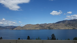
Saturday 29 June 2024

Day 42: Home Sweet Home

West Kelowna, BC

Distance for the day: 282.7.5 km

Cumulative distance: 9,665.7 km

Top speed: 119 kph

Moving average: 75 kph

Temperature:  21.4 - 37.0

Incoming weight: 160 lbs. Only added one pound.

We are home and happy about it. I'm not going to write too much about it but here are some pictures. We are happy to be home.


Exclusive motorcycle parking in Republic.

Republic had many old buildings from when it was first established around the turn of the last century.

Even though some buildings looked like there was something going on, often it was nothing. There was frequently signage at the doorway indicating the heritage of the building but several were dilapitdated inside and looked like they would need so much work that it would hardly be worthwhile.


This building was for sale. Not sure who would take this on as a project in a small town with little going on.


The Northern Inn in Repubic. A favoured haunt of motorcyclers. There was actually few choices for accomodations in the area but this turned out to be a pretty good choice.


Still on the US side of the border, this was the bridge into Curlew.

This is an old building in Greenwood, on Hwy 3 in southern BC. This is reminiscent of buildings we frequently saw in US small towns.


Anarchist Mountain near Osoyoos.  Somebody getting ready to celebrate Canada Day.

We spent the day wathing the clouds wondering if we were going to get rain but nary a drop.

Oliver vineyard. It is going to be a tough recovery.


We are so lucky to live in a beautiful part of Canada.

We had a nice bottle of Champagne when we got home, toasting and admiring one another for a job well done.

It was a big adventure, to be away for as long and as far as we went. Not sure if we will do a trip as ambitious as this one again but I can say that we both had a ton of fun. I think Nan is an extraordinary woman to be able to participate in such a trip. Let's face it: we're not kids anymore and to be able to sit on the back of a bike for six weeks and camp, let alone motel or hotel is really something special. She also took 90% of the pictures, helped curate them and did more than her share of the work in loading the bike and looking after the gear. 

Principal photographer, curator and guidance counselor,  The Lovely Nono Nanette.

If you are reading this, chances are you have followed along for basically the entire trip. I write the blog because it is a good keepsake for our own purposes. Years after the trip is over, when we look back, we will remember what fun we had and what beautiful scenery we saw. However, it is fun for us to share this with our friends. Thank-you for allowing us to share this journey with you.

Friday 28 June 2024

Day 41: Republicans or Democrats

Republic, Washington

Distance for the day: 275.5 km

Cumulative distance: 9,383.0 km

Top speed: 115 kph

Moving average: 75 kph

Temperature:  18.2 - 31.4 

Pretty easy day. We were basically taking one really long day and splitting it into two short days by going only as far as Republic. Going all the way home yesterday would have been a little too much so we elected to have a break and a comfortable ride rather than dragging our sorry posteriors through the door late into the afternoon or early evening.

According to Garmin, there are twelve cities in the U.S. with the name "Republic" or some derivative, including "Repubican" (New England), to say nothing of the hundreds if not thousands of businesses that turn up with the name. As a little excercise, I asked Garmin for the directions to "Democrat". No such place. There is a Democracia in Brazil and according to Google Maps a field in Idaho called Democrat but no populous place with that name. Biden doesn't stand a chance. 

On the other hand, the town of Republic, Washington doesn't look like it stands much of a chance either. With a population of around 1,000, give or take, there are a lot of borded up businesses here with decrepit, falling apart buildings on main street with for sale signs. I have been through Republic a number of times on the motorcycle but never stayed over.

What they do have is a motel called The Northern (to them) Inn that makes a point of catering to motorcyclers, including a motorcycle wash station with a hose, rags and soap and designated motorcycle parking in one part of the parking lot. Also, when making the reservation, I was asked if I needed "motorcycle cleaning materials". Despite that, there is only one other motorcycle here tonight (so far, at 8:30). The other thing the town has is a self-identified "LGBTQ-owned" restaurant which we found a little surprising since these parts are strongly conservative. We had dinner there and made a point of telling the owner why we chose her restaurant. She said only one other person had ever mentioned it.


We had lunch in Priest River. My one brother had emailed me to tell me, when he saw our proximity to Priest Lake, that our dad had taken us there in the past. I had zero recollection of this and I suspect it had happened before I was born. As such, there was no "emotional diversion" to be made.


We rode through Kettle Falls and Roosevelt Reservoir, where I had passed on a small solo motorcycle trip in Ocotober of 2022.

Riding over Sherman Pass on the way to Republic we stopped for a little break at an outlook and there were many wildflowers there in bloom, including these below and newly sprouted wild strawberry blossoms.


The White Mountain wildfire remnants of 1988. 


Thursday 27 June 2024

Day 40: Heading in a northerly direction.

Athol, Idaho

Distance for the day: 393.7 km

Cumulative distance: 9,107.5 km

Top speed: 130 kph

Moving average: 78 kph

Temperature:  14.0 - 30.2 

We were awake early. Really early: 4:30 am to the sound of birds singing their hearts out. Isn't spring past? They should be raising families by now. I will say that they sound happy, even though they should be sleepting. We talked about getting up then and getting going.


The next sound we heard was rain falling on the tent. Not nearly as cheerful as the birds singing. But it fell. The NEXT sound we heard was snoring. BOTH of us! We were convinced that when we were awake, we were awake for good but asleep we were until just after 7:00 am. We did get up then but everything was wet: the tent, the fly, certainly the ground sheet, we even had moisture inside the tent. Camping is hard enough without the rain; I have long since lost the desire to beat nature. I just want it to be easy. I feel I can confidentely say the same for Nan.

So, it takes a little longer to get organized when everything is wet. But we did get packed and we were on the road by 8:45. For the first time in several weeks, we start out wearing pants (as opposed to shorts) andour heated jackets, but without the heat. Even though the weather looks to be threatening somewhat, it is actually warmer than we expected at 14. By the time we were pulling away from the campground, we had already seen 10 motorcycles ride by. They must not have been camping. 

The last 40 km of the park was really lovely and oddly enough, I had a slightly different perspective on the landscape today than I did yesterday. We had been camping and riding by the Lochsa River which carves a beautiful figure in the valley. But once again, we were riding without a destination. That was in part because there was no cell service last night so we could not do any route planning. Nonetheless, we rode until we could get a nice coffee and some internet (to update the blog) and to find a destination. We are starting to look at the route home a little more carefully, so looking at one potential route home, we targeted an interim destination of St. Maries, Idaho and we would decide our final destination when we got there. 

We spent most of the morning riding alongside rivers and abandoned rail lines. Both made for interesting viewing. The railway was clearly long-since used since it was well overgrown with weeds, shrubs and bushes. However, we came along a section that had much rolling stock, mostly flatbed cars, the kind I presume are used for transporting c-cans as well as a smaller number of cars used for hauling logs to be processed into lumber. It was amazing how many rail cars were parked on this abandoned line, perhaps thousands as they went on for ten or twelve kilometres. Hard to understand how they can park that much rolling stock and abandon it because the rail line didn't look in good enough shape to retrieve the cars.

Orofino. Many of the place names in the
 last two days have Italian origins.

We did, in time, turn off Hwy 12, crossed the Clearwater River and into the hills on a

Abandoned rolling stock south of Kendrick.


shortcut to Hwy 3, which would take us north. This little shortcut took us over McGary Grade Rd, which took us over the hills to Kendrick but in the process, down a 9% grade. Not Bella Coola steep but steep and twisty enough that I kept the bike geared down and my hand on the brake.
The hills above Kendrick.


Kendrick is a typical small, old US town with buildings usually made of brick, from the late 1800s and early 1900s still in use. Tons of character, occasionally intact but hanging on by the fingernails. There is usually a brew pub or micro brewery in every small town in one of these buildings.


Looks more like Amityville than Kendrick.


St Maries was a bigger version of this and when we rolled in around 2:00 pm our first order of business was to find some place to eat, since all we had had at that point was a latte, protein bar and cinnamon bun. We had pulled over to the side of the road to look at the signs on the main street and Nan, in something of a hurry, asked a passerby where to go get food and the helpful person first welcomed us to St Maries then gave us about ten suggestions. I mistakenly assumed by the number and location of her piercings that she wouldn't have much to offer but I was wrong. 

We ended up having a pretty good lunch and spent a fair amount of time finding a destination for the night and after several failed attempts to find a suitable place, settled on Athol, just north of Coeur d'Alene, another 114 km from St Maries.


The rain once again threatened us this afternoon. However, rather than wait until we were wet, we donned our raingear. This proved to be an outstanding decision because despite very heavy, dark clouds in the direction we were heading, we kept the rain at bay.  We even kept our rain gear handy through lunch and afterwards, every place we rode appeared to have just been deluged with rain but hardly a drop on us.

When we got to Athol, we were told by two separate people that they had had bad storms today. The owne of our motel told us the power had been out twice today due to the storms.


An amusement park that Nan is begging me to take her,
just outside of where we are staying tonight.


Day 42: Home Sweet Home

West Kelowna, BC Distance for the day: 282.7.5 km Cumulative distance: 9,665.7 km Top speed: 119 kph Moving average: 75 kph Temperature:  21...