Saturday, 1 June 2024

Day 14: Big Surprise at the End of the Road!

Day 14: Santa Cruz, California

Distance for the day: 296.0 km

Cumulative distance: 2,854.4 km

Top speed: 128 kph

Moving average: 67 kph

Temperature: 15.8 - 22.4

We opted to forego Salinas in favour of another night in Santa Cruz so that we would not have to pack up and move today and just carry on to San Luis Obispo on Sunday morning. This allowed us to have breakfast, lounge around the room drinking coffee and talk about where we would visit, which was a pretty easy discussion: we would ride down the coast to Big Sur. If you are our generation (or older) you might remember Johnny Rivers singing about Big Sur (You must be over 65 to use this link.)

Some murals painted along the
highway through Santa Cruz.


Sand dunes ready to engulf the highway.


This is typial of the geology along the
edge of the road towards Big Sur.


This was the area still under repair but
with traffic control to allow vehicles to
pass on the single open lane.

A careful check of the map revealed that the route to Big Sur is a continuation of Hwy 1 down the coast, so I was expecting more of what we have been seeing however, between Santa Cruz and Carmel-By-The-Sea it is pure slab riding of four or six lanes of heavy traffic. There were not twists, few turns and rather than scenic views of the ocean, we were treated to endless miles of farmland where we saw strawberries, and artichokes and a few other low ground vegetables. There was many vegetable stalls where lemons were sold (7 for $1) and avocados (also 7 for $1) and local pistachios, all exotic to us. Also, being a Saturday morning and the kick off to the summer season (at least, in our eyes) I am guessing that the traffic was probably busier than a typical Saturday of people going off to the beach. Also, even though it was heavily overcast and looked like rain, the forecast was actually for a sunny day so I am sure lots of people wanted to take advantage of that. 

So, an hour to Carmel-By-The-Sea in heavy traffic and gloomy skies. Past Carmel, the road got narrow and twisty, though not gnarly tight like north of San Francisco. There were moments where the look over the edge was quite precarious and on one occasion I just said to Nan, "don't look over" and she confirmed that she had no intent. But the traffic remained very heavy and every turn-out and vista point was overloaded with vehicles filled with people out on an excursion for the view. We stopped several times and took our turn, particularly when the turnout was paved. We had a discussion about which coastline was better: north of SF or south of SF. I largely had to defer because Nan sees much more than me. I see a lot of road, even though I ride much slower hoping to look around a little more, if there is a 90 degree turn pending, speed has little to do with whether you are looking around. I don't think we really came to a conclusion. 


We hadn't been to Big Sur for maybe twenty years. We had taken a rental car there when visiting a friend in the area but I really remembered very little. It is not a village like a little Banff, it is more like a collection of businesses at varying distances along a road may 10 or 15 km long. Also, some, what appear to be, very expensive homes interspersed. Big Sur is the big surprise (at the end of the road)! There are three gas stations, numerous inns, campgrounds, convenience-type stores, and cafes and a few restaurants. They are not even necessarily collected together but in small groups, most of which compete for parking space for their customers. We had seen a sign near Carmel-By-The-Sea indicating that Big Sur businesses were open, to try to keep discouraged travelers from bailing out of the drive down the coast, which they had likely been doing due to the washed out road. A year ago January, heavy rains washed debris down the side of the mountains, taking out four sections of highway between Big Sur and Cambria, some way to the south. One section has reopened, though repairs are not completed and we rode through that section today. The other three are much more severe and two are expected to reopen in July and the last in the fall. At one time, our plan would have been to ride Hwy 1 all the way to Cambria and continue on south along the coast but that is not possible at this time. We rode to the end of the road, which in fact, is not exactly where Big Sur is located. It is about 26 km south of Big Sur.

The end of the line. No surprise after all!

We saw what we thought were
horses stranded on this bluff!

Turns out there is a trail.


5-way intersection in Carmel.
I have never seen that before.

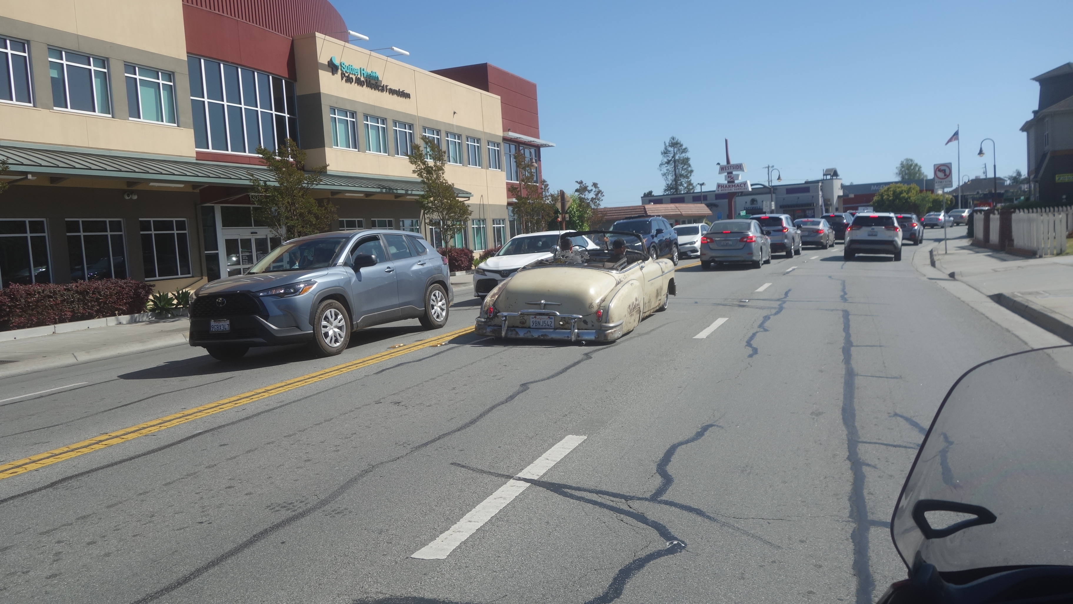
Just about back to the motel
and we saw this car.

They are the local bad asses.


As such, our route today was a simple out-and-back. There were no short cuts, scenic routes or diversions, other than a brief ride through Carmel-By-The-Sea. I suggested to Nan that we get off the bike and walk around the shops a little, to which she replied, "not in these boots!" I said, "But Sweetie, those boots are made for walkin'!" We just kept riding. 

And me, of course.
It was nice riding today without
all the gear strapped to the bike.


Friday, 31 May 2024

Day 13: GOLD!

Day 13: Bodega Bay, north of San Francisco about 110 km

Distance for the day: 243.3 km

Cumulative distance: 2,558.4 km

Top speed: 112 kph

Moving average: 59 kph

Temperature: 19.2 - 31.4

A relatively short day distance-wise but it was a long time on the bike because we were riding though really twisty terraine as we navigated our way down the coast. 

The view from the Bodega Harbour Inn

We got a late start, not because we were laying around in bed but rather, I was trying to solve some logistical challenges. One: I had to figure out how to pay a road toll coming later in the morning. It has been a few years since it was possible to pay a toll with cash by dropping the money into a bowl while going through a gate. Now, payment is made by subscription and regular users get a tag that is scanned as vehicles pass by a sensor or, for users who use the toll less frequently, their license plate is scanned. ONE time users, like me, can pay in advance by registering a license plate and then driving through the gate where the plate gets read. Payment is made online of course, and I can tell you, it is somewhat of a challenge to find the place for out-of-country users to register a license plate. Especially as the section for users to register a license plate has a drop down box allowing users to choose any of the 49 other states than California. Seems they overlooked a choice for non-American users, even though the website makes it clear that foreigners have an obligation, too. I phoned to try to get it resolved and I was just told that they wil send the invoice in the mail, (with a penalty), even out of country. That was one time-waster. Then, we had to figure out where we were going for the day. Found a pretty good budget flea-bag with good reviews in Salinas but they don't seem too inclined to answer their phone or emails. We ultimately decided we would take off and figure it out when we get there, wherever "there" is located. We had an 11:30 departure from Bodega Bay.

It was twisty, twisty, twisty and it was relentless. But today, not only was the road twisty, it


was up and down and when it twisted, there was often a 1,000 foot drop off the edge of the road. I have to say that it was somewhat unnerving. Riding the hard curves is no place to be glancing around but to be that high up with effectively no bottom had me gripping the handlebars extra tight. Even Nan couldn't look away; at the time she said to me that she was just holding the camera out and taking pictures with one had while the other was firmly gripping my jacket.

This went on for an hour and a half ( about a hundred kilometres) as we rode down the


coast, eventually coming to Muir Beach and then the road turning inland. I had remembered from the map that that turning point was going to take us to San Francisco and probably some freeway to get us there though I had misremembered how little travel time there would be so before I knew it, we were on the freeway just outside of Sausalito.

We then crossed the Golden Gate Bridge. This was a "moment" for me because I never thought I would be riding over such an iconic landmark. There was a fairly strong crosswind so I couldn't look around too much but Nan, as is most often the case, took lots of pictures so that I could see later what I rode earlier in the day. 


We ended up riding through San Francisco mostly on Highway 1, which skirts the busy part of the city so we didn't have to ride a freeway or through the busy part of the city. Still, we did have a few challenges. Even though this was identified in the GPS (which I ignored) Highway 1 (The Great Highway) is closed in one section of San Francisco. This


doesn't seem to be temporary, like with road repair or something as there were sand dunes accumulating on the road. Apparently, the city has long foreseen the eventual permanent closure of the road to build up the terrain to combat rising sea levels and protect the city. Sand encroaching on the road is an ongoing problem.

By the time we reached Pacifica, we had gone too long without food and were desperate to kill something. Fortunately, after turning off the freeway, the town yielded up many possibilities for lunch. We stopped at a kebab place in a strip mall and ended up having a really good meal.  It was mid afternoon so I guess I shouldn't be surprised that we were the only ones in there but it seemed weird, especially given how much we enjoyed the food. We told the gal working there that we were from Canada and she told us she was from Turkey, so I was able to relate to her how much I had loved Turkey when I was there in 1982 as a kid hitch hiking around the world, particularly as the people had been so kind to me.

The coastal highway south of San Francisco is a different ball of wax than what we have been riding for the past week. Not so dramatic, distances between communities was much shorter and much of the land is farm or ranch land. Still pretty in its own right but a little anti-climatic after taking our lives in our hands riding on cliff edges. 


Our intended target for the day had been Salinas but by the time we got to Santa Cruz around 4:30, we felt like we had had enough and, after riding around bit, picked a motel. I have noticed that the further south we go, the prices go up. We weren't married to the idea of Salinas, particularly as we hadn't been able to successfully reach what I thought would be our motel. We also wanted to see the Oilers game which had a 5:30 start.


Thursday, 30 May 2024

Day 12: The Coastline is Spectacular

Day 12: Bodega Bay, north of San Francisco about 110 km

Distance for the day: 130.3 km

Cumulative distance: 2,315.1 km

Top speed: 99 kph

Moving average: 54 kph

Temperature: 15.8 - 24.6

But there are other good things, too. 

We awoke B&E to the sounds of bird song. Many different kinds of birds, the varieties that we could only guess but we definitely heard Morning Doves and American Goldfinch. We saw them, too. "Flying lemons" as a friend once called them. But the air was filled with the sound of them.

I had a desire to see Point Arena Lighthouse but since it didn't open till 10:00 am we decided to go into Point Arena proper for breakfast before going to the lighthouse. Point Alert was only 10 km from the campground and past the lighthouse but we didn't really want to hang out for the sake of hanging out.


Point Arena, like many backwater US towns, is small, somewhat forgotten and lonely. However, it is a little bit touristy and I had the impression the tourists must be hippies. We had breakfast at the co-op, which is really a co-op as opposed to the name of a big chain, and we used the opportunity to upload yesterday's pictures, which was a treat for me because I didn't have to sit around for an hour to painstakingly upload one picture at a time. 


Once done there, we backtracked a few kilometres to visit the lighthouse and take in the small museum and large views. We saw signs warning driving visitors to be watchful of the lighthouse resident cat. We looked everywhere hoping to get a cuddle but none was had. But the views were amazing!

After spending an hour there, we were headed off back south along the windy, twisty Hwy 1. Like the days before this one, we were treated to some pretty spectacular views. 


Our destination was Bodega, famous for the filming of Alfread Hitchcock's The Birds in 1963. We went and had dinner at the Tidewater, an over priced restaurant that under delivered. The only bird on the menu was chicken. 

We kept it a short day because Friday we ride throuh San Francisco  and while we could have made it through today, traffic was moving too slow to really capitaize on the short distance. Tomorrow we will try to get as far south as we are north of San Francisco tonight.

Day 42: Home Sweet Home

West Kelowna, BC Distance for the day: 282.7.5 km Cumulative distance: 9,665.7 km Top speed: 119 kph Moving average: 75 kph Temperature:  21...