Day 16: McGill Campground, Chumash Wilderness, California
Distance for the day: 321.4 km
Cumulative distance: 3499.4 km
Top speed: 116 kph
Moving average: 73 kph
Temperature: 18.8 - 33.0
Oilers: Stanley Cup contenders
Elevation: 2308 metres, versus 1, which we have been living for the past two weeks.
I'm pretty sure I have used that post title on a past blog and that would be because I have been in a similar situation.
Every morning on this trip, it seems, we think we are going to get away and then we don't. Or we DO, then we (the Royal We) realize that something is wrong, like what's up with the GPS saying go that way or it's not saying anything at all.
 |
| Kathy, Warren, Nan and me sitting around the post breakfast table. |
 |
| Enjoying their beautiful garden with citrus fruits... |
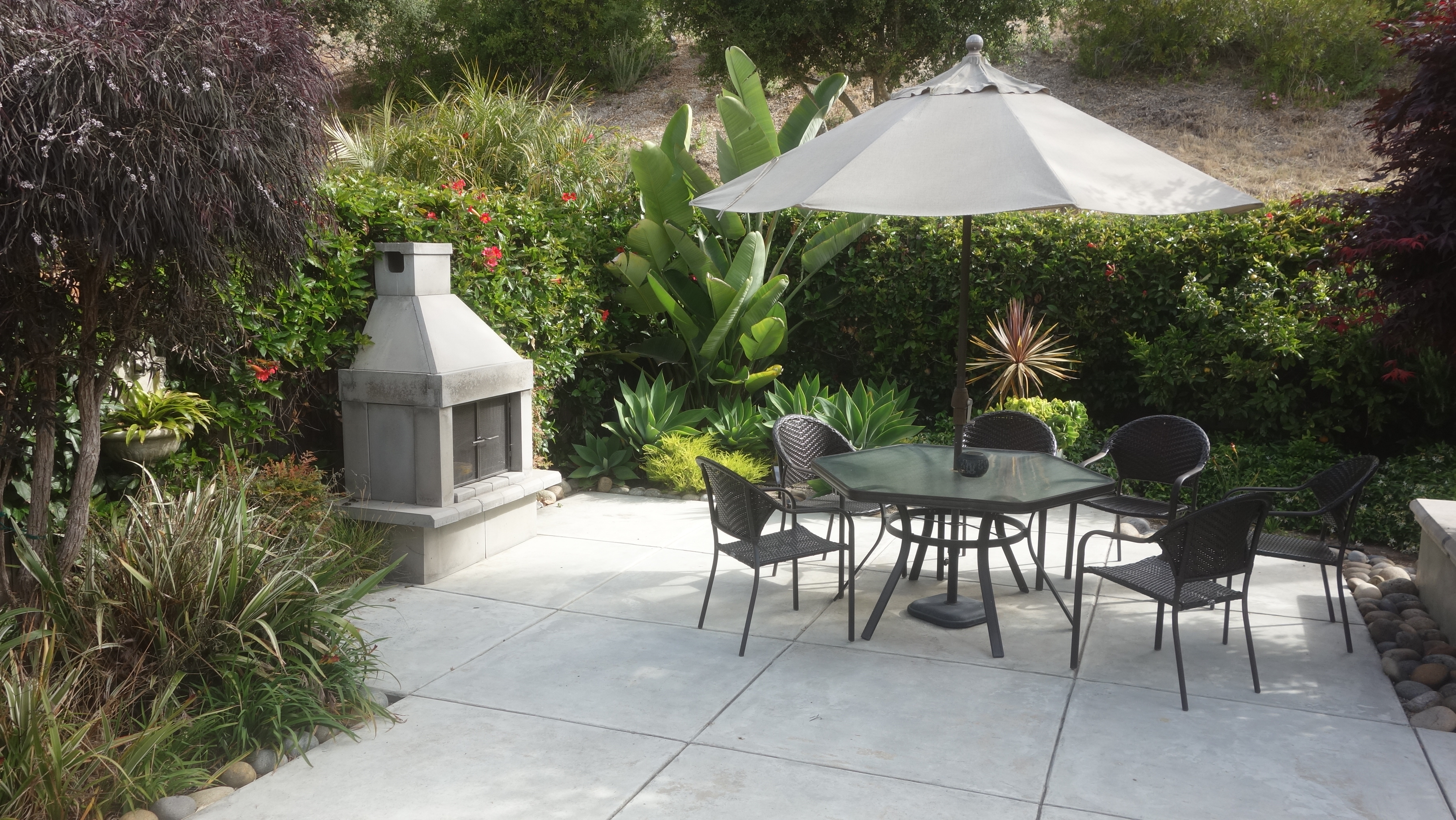 |
| ...and bird of paradise. |
We left our gracious hosts' place just past 10:30. It was a relaxed morning; we were fed and served espressos so that we could be sufficiently wired for the road. We didn't get two kilometres before I realized that we were going the wrong way, whichever way that was. Last night, Warren had pulled out some big paper maps so that we could have an all encompassing, bird's eye view of California, Arizona, new Mexico and Colorado to make some good and interesting route decisions. Warren had proposed we take Hwy 58 east
 |
| This is the house in Toronto, now occupied by our friends Daryl and Wendy and once owned by Warren't grandmother, who is sitting on the porch. |
from Santa Margarita to Frazier Park, which is just before we would hit Interstate 5 which goes south to L.A. I entered that into my Google Maps and it actually gave me a different proposed route which would take us over Hwy 166. Then Warren said "but wait, there's more!" He said that would also be a very good way, a little shorter and maybe even a little better than Hwy 58. So there we are, heading north towards Santa Margarita and I realized I hadn't programmed Hwy 166 into the GPS and couldn't actually remember which highway was the one to take us south, then east to Frazier Park. I said to Nan that we had to stop to sort this out. Two kilometres from our starting point.
Since I didn't remember which was the southern route, we elected to just keep keep heading north and watch for the signs for Santa Margarita and surely it couldn't be a big deal to just follow the road until we saw Hwy 58. So we are riding up Hwy 101, backtracking the way we had come down, soon saw the exit sign for Santa Margarita and Hwy 58 and took that exit. Easy. As. Pie.
Until we blew by the turnoff for Hwy 58 and continued heading north. Shortly, I realized
 |
| Oops. Not where we are supposed to be. |

that we were riding parallel to Hwy 101 and I just knew that wasn't right so once again, we stopped to get our bearings. Then we turned around, rode back 7 km and found the turnoff. BTW, the sign for Hwy 58 was virtually enshrouded in tree branches and leave, at least, this time.
First sign we see: "Route not recommended for trucks", which we thought was a good sign, both figuratively and literally. So, as had been foreseen, it was a good, twisty road through lush, pretty countryside, some small farms and a few wineries.
Once through the hills and out onto the plains, we quickly realized we were in ranch
 |
| Where we are supposed to be. |

 |
| Oh oh. Someone didn't make the turn. |

country. SOLAR ranch! We thought that was hilarious that they are upping their cache by calling their solar farm a solar ranch! The California Solar Ranch. I bet there is a lot of wrangling going on there, much more so than at the Topaz Solar Farm, which we had passed by a few minutes earlier. Both had what appeared to be hundreds of acres of solar panels.
We were our riding in desolate country at this point. There were wide, open plains
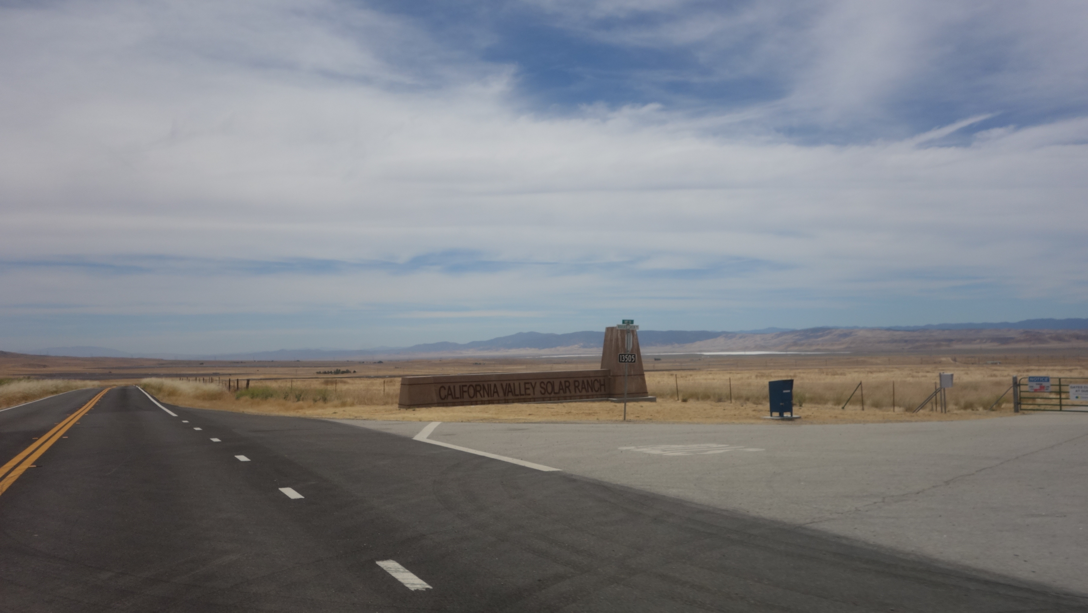 |
| The solar ranch. You can see the panels in the background. |
followed by a smattering of oil pump jacks, then a congestion of pump jacks where hundreds were squeezed into a few acres. There must have been a rich deposit below. It looked out of a science fiction movie of some future desolate, far off planet being exploited for its resources. Especially as we entered the related community of Daft, sorry, Taft, many of the businesses seemed to be shuttered. However, that did improve as we got closer to the centre of the town.
After a generous break at the Daft Starbucks, by which I mean generous to Starbucks, with new coordinates programmed into the GPS (HA!) we headed out again. Editor's Note: I do not generally used voice commands from the GPS when I am riding with Nan because the GPS interupts us, so I rely on the screen to take my cues when to turn. We are riding down what we think is Hwy 58, having continued on the route we had used into Taft. Unbeknowst to me, we were now on Highway 166. Sound familiar? Then I see a sign that says how far it is to Hwy 101 but I think it must be referencing some alternate route. But get this: we are heading WEST. I don't pick up on this fact, though until, after about 20 minutes, the GPS is signaling to me to turn around. This I find very frustrating when I have been watching the route on the GPS and it is suddenly talling me I should be going the opposite direction. We pull over so that I can sort this out.
Turns out we have followed the highway, which has curved around and started back towards the coast. I don't even realize we have changed direction. But I check the GPS compass and we are clearly heading west. I reset the GPS target once again only this time entering the coordinates of a campground that might make a worthy target for the night. and we have to retrace 24 km, which you can clearly see on the tracking map. I am embarrassed and humiliated. I've made Nan suffer these extra 50 km on her tender tootsie. I wasn't even certain how it happened though my theory was that the GPS had been pointing to the turn and I just didn't notice and blew past it. The GPS continued to show me to keep going because it thought I had to get all the way to New Cuyama for a safe place to turn around. Sheesh.


We get off 166 and onto the Hudson Ranch Road. I find this name interesting because the only ranch or really, any kind of rural dwelling didnt even appear to be occupied. Maybe it was a ghost house. But the road goes through spectacular hilly country and while Nan is snapping away, I am keeping my eyes to the road but eventually I say I have to stop and take a look because I had never seen anything like it.
Continuing on, we are getting some good elevation and the surroundings are more dense forest. Also, there is a slight uptick in traffic, which is comforting because initially, we thought we were on the loneliest road in California. We actually came to Pine Mountain Club, a name I had seen on the map and assumed it was some sort of special camp for kids or someother. It was actually quite an elaborate little town with services and businesses - in the middle of nowhere.
We made the turnoff to the campground which turned out to be about 8 kilometres off the highway on a steep uphill incline on, I am happy to say, paved road.
It is 9:00 10 degrees and windy so that's it.


No comments:
Post a Comment
All comments are moderated without prejudice. Please note that the Blogger platform prevents me from responding directly to your comment and that unless you are posting from a Gmail account, your name will appear as anonymous and I will not be able to identify you, so please include in your comment some way I can identify you!