Palisade, Colorado
Distance for the day: 338.4 km
Cumulative distance: 6,687.5 km
Top speed: 114 kph
Moving average: 69 kph
Temperature: 18.2 - 37.4
 |
| This is our new friend Jim, from Ashland, Virgina. |
Nan had fetched lattes, as has been her custom for the last several days, which is leaving me feeling a little humbled because I see it as my duty to bring her a latte in bed every morning, even if we are on the road. While she did that I busied myself getting things organized to get loaded onto the bike.
I took a little break to sit on one of the chairs outside our suite to enjoy my latte and sitting in the next set of chairs was Jim, and, like many people we have met on this trip, Jim is a friendly sort and we quickly struck up a conversation. Jim was occupying the room next to ours and is a regular at the Siesta Motel. He told me he had been up in the hills with is rental hybrid Jeep "acting half his age" and Nan and I look at each other because that is bacially my line! In no time, Jim was regaling me with stories from his past (i.e. "youth") when he lived in Durango working in the gold mines in the area and his somewhat brief time "incarerated" in college. Jim basically claimed that he was not an educated man but he was clearly rich with street smarts. I think we immediately took a liking to each other and I was quickly engrossed with his stories. We gabbed for over an hour and I realized that if I sat there much longer, we might not leave. In fact, I had pitched the idea to Nan that we stay another night; there are lots of things to do around Durango. And in fact, Jim knew the back roads and I am sure with his help we could have found some cool places to visit, if staying for an extended stay. Even though there is a nominal 50-50 tie when Nan and I vote on such things, somehow the tie breaker falls to the woman.
Jin was visiting Durango on a lark; completely unplanned and on a spur of the moment. I somehow think there was more to this story but it didn't get told. Jim had just presented himself at the airport and indicated that he wanted to be in Durango and the United Airlines desk agent somehow made it happen. I could see that Nan was getting restless doing my chores packing the bike, so I took my leave. After we left, Nan said we may have dodged a bullet by getting out of Durango when we did. Bad decisions lead to great stories but I think these stories will have to wait.
We had a pretty spectacular day, going over four passes in excess of 10,000 feet, with the highest one being 11, 018 feet. Somebody had asked me once if the bike complained when we went over our previous highest pass which was about 10,900 feet so I couldn't help but wonder if the bike might stall or sputter but she carried us up the steep incline without so much as a hiccup. This highest pass was Red Mountain Pass but the pass shown here was Molas Pass, no slouch in and of itself but was only 10,640 feet.


Shortly after we were overt he pass, we saw from above a sleepy town in the valley below. Not exactly low, it was Silverton, a former mining town, at elevation 9,318 feet. This was a pretty big town, not some deserted ghost town abandoned in the mountains. Literally the same moment that we rolled into Silverton, the Durango - Silverton Express rolled in: a steam engine train on 3-foot narrow gauge tracks now hauling tourists up from Durango. The tracks to Silverton were completed July of 1882, and the train began hauling both passengers and freight.
 |
| Silverton, from above. |


There is a two hour stop for the train while in Silverton and then it carries the tourists back to Durango. When we saw the train steaming into town, we chased it down compacted gravel roads attempting to get close enough for pictures and eventually, we ended up meeting it right in the heart of downtown Silverton. We were standing in Silverton taking pictures and passengers were spilling off the train, all with the same thought as us: get lunch now, so Nan quickly went over to a restaurant and got us a seat while I parked the bike. Within seconds of Nan getting us a spot in the restaurant, the place was packed with people lined up to get inside. In my old restaurant days, we called this "getting slammed" and restaurant stuff were literally running... maybe for cover but they do this literally every single day.
 |
| The train operates year round. Hopefully, winter passage is not in open air rail cars. |
 |
| Nan is standing on one of the rails here. You can see that it is much narrower than regular train gauge. |
 |
| While we were having lunch, the steam engines were swapped with diesel engines. The steam engines went back to Durango on their own. |

 |
| There is no mining activity in the region any longer. Silverton survives on tourism and government-funded infrastructure projects. |


 |
| Red Mountain Pass, at 11,018 feet. A personal record for us both. |
Once we were done with Silverton and Red Mountain Pass, we were making our descent down the "Million Dollar Highway", a route that had been completed by entrepreneurs as a toll road in the early 1900s. Apparently, it cost $10,000 per mile, a fortune in those days.
It was carved out of the side of a mountain and the drop off was extremely steep - vertical really - and no guardrails. It was extremely unnerving, so much so that the trip's official photographer could not look over to take pictures. At one spot, the road had been repaired on the edge and it looked like part of the road had crumbled away. I couldn't say with certainty that that is what had happened but I can tell you that I was glad we were in the inside lane. Somebody told me later that they could not drive up that road.


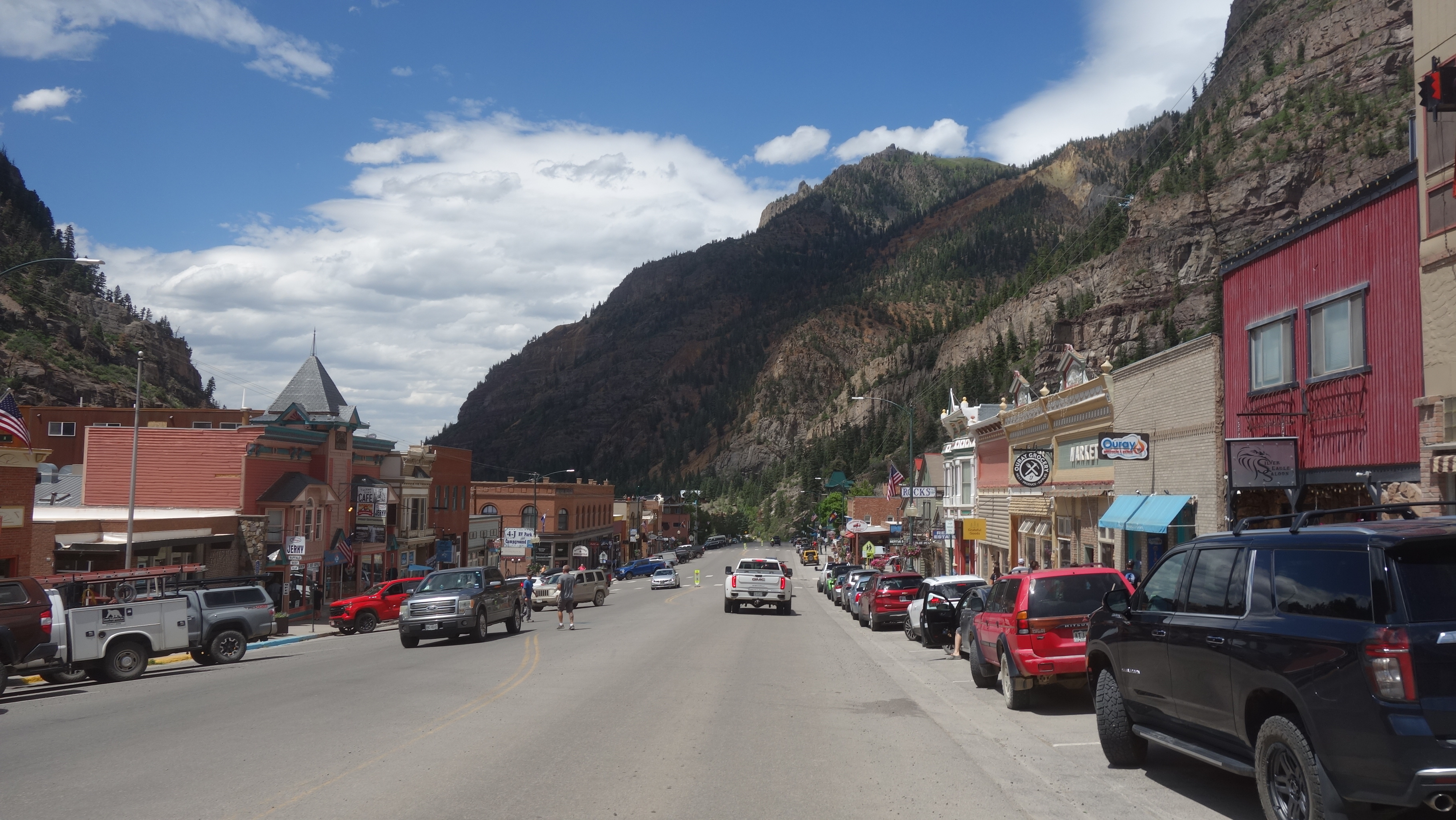 |
| Ouray, yet another ex-mining town surviving on tourism. Looks like it is working for them. |


 |
| We had this great view back from where we had just come. |


 |
| Approaching the town of Mesa, our route was blocked by a vehicle fire and the road was closed, so we ended up turning back taking side roads to get back to the highway. This included this gravel road, where we were promptly coated in dust. |


No comments:
Post a Comment
All comments are moderated without prejudice. Please note that the Blogger platform prevents me from responding directly to your comment and that unless you are posting from a Gmail account, your name will appear as anonymous and I will not be able to identify you, so please include in your comment some way I can identify you!